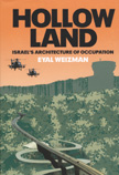
 …view: Hollow Land. The Architecture of Occupation: An exploration of the political space created by Israel’s colonial occupation. From the deep subterranean spaces of the West Bank and Gaza to their militarized airspace, the mechanisms of control and the transformation of the Occupied Territories into a theoretically constructed artifice is shown, in which natural and built features function as the weapons and ammunition with which the conflict is waged. Und bei aller Perspektivenkritik nicht ganz ohne Relevanz: Kartenmaterial. Ein kleiner Video-Clip mit moderierten Landkarten bietet einen recht vernünftig geratenen Einstieg/Überblick über die Problematik Mauer/Grüne Linie, aus der arte-Reihe „Mit offenen Karten“.
Zum Inhalt springen
